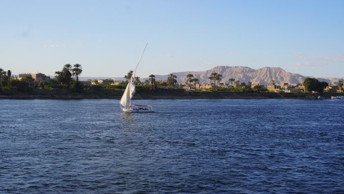
Luxor works as two separate halves joined by the river. The East Bank holds the railway station, most hotels, restaurants, Luxor Temple and Karnak. The West Bank holds the Valley of the Kings, Hatshepsut, Medinet Habu and the Colossi. For the river, the public ferry runs every few minutes through the day and is the simplest crossing; private boats leave on demand. On land, taxis and app-based cars cover longer distances, while the East Bank Corniche and the temple sites are walkable. Build the day around one side where possible.
The river decides the route
The Nile is not a backdrop in Luxor, it is the organising line of the city. Everything on the East Bank connects on foot or by short car ride: the railway station, most accommodation, the restaurants, Luxor Temple and, to the north, Karnak. The West Bank is a different geography, a strip of villages, fields and monuments reached only by boat or by the bridge.
That means a Luxor itinerary is mostly a set of decisions about when to cross and how. Crossing twice in a day costs time; crossing once and staying on one side until evening is usually calmer and cheaper in effort. Plan the East Bank for arrival days, evenings and the temples, and give the West Bank a full morning or a full day.
Distances on each bank are short enough that walking covers the dense parts, while the monuments on the West Bank are spread over several kilometres of fields and desert edge, where a vehicle or a bicycle does the work.
Ways across the Nile
Getting around the East Bank
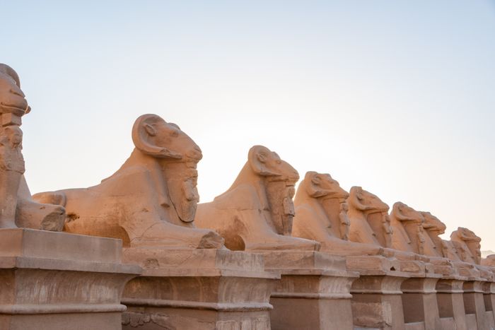
The East Bank is the walkable half. From the railway station and the city centre, the Corniche al-Nil runs north to south along the water, with Luxor Temple at its southern end and Karnak a straight, signposted avenue to the north. The Avenue of Sphinxes links the two temples, and much of it can be followed on foot.
For anything beyond walking range, taxis and app-based cars are the usual answer. Drivers cluster near the station, the temple entrances and the hotel strip, and rates are negotiated or shown in the app before you accept. The Corniche al-Nil walk is the pleasant spine of an evening, with the river on one side and cafes on the other.
The souq and the restaurant streets sit just inland from the Corniche and are best covered on foot, since traffic and parking in the centre make short car trips slower than walking.
West Bank logistics worth knowing
Day trips outside Luxor
Three temple towns sit within reach of Luxor by road along the Nile: Esna to the south, then Edfu further on, and Dendera to the north. These are road journeys rather than river crossings, and they are usually done as organised day trips or with a hired car and driver, since public transport to the sites themselves is indirect.
Dendera and Esna sit on the same bank as the East Bank of Luxor, so the crossing question does not arise. Abydos, further north beyond Dendera, is the longest of the standard day trips and needs an early start. Aswan, far to the south, is a journey rather than a day trip for most visitors.
For all of these the practical questions are the same: which sites open when, whether a guard or guide is required at a particular tomb, and how much road time is involved. The day trip guides set out each one separately.
The one rule that saves the most time
Group each day around a single bank and cross the Nile once, at the start or the end. Crossing back and forth to collect scattered sights costs more time than any single journey on the ground.
Questions
How do you cross the Nile in Luxor?+
The public ferry runs every few minutes through the day between the East Bank landing near Luxor Temple and the West Bank, and it is the standard crossing for foot passengers. Private boats wait at the same landings and offer direct crossings on demand. There is also a road bridge south of the city for vehicles and bicycles. Late evening service is thinner, so confirm the last departure at the landing.
Can you walk between Luxor Temple and Karnak?+
Yes. The Avenue of Sphinxes runs north from Luxor Temple towards Karnak, and the route can be followed on foot, though the full distance is a long walk in the heat. Many visitors walk part of it or take a short car ride and walk the rest. Early morning or late afternoon is far more comfortable than midday.
Do you need a car on the West Bank?+
The West Bank monuments are spread over several kilometres of fields and desert edge, so walking the whole set in one day is unrealistic. Taxis, bicycles and organised transport are the usual options, and the ferry landing is not beside the main sites. A vehicle for the day lets you cover the Valley of the Kings, Hatshepsut and Medinet Habu without long waits.
How do you reach Dendera and Esna?+
Both temples are reached by road along the Nile, Esna to the south and Dendera to the north, and both sit on the same side as the East Bank of Luxor. Organised day trips and hired cars with a driver are the common arrangements, since public transport does not stop at the temple entrances. Check opening hours for your date before travelling.
Is it better to stay on the East or West Bank?+
The East Bank suits first trips and short stays: the station, most hotels, restaurants and Luxor Temple are there, and the ferry to the West Bank is a short walk away. The West Bank suits longer stays, quieter evenings and early starts at the monuments. The trade off is convenience against proximity to the tombs and cliffs.